


Hokuriku region Ishikawa prefecture | Our Regional Cuisines

The taste of “Kaga Hyakumangoku” that blossomed with the plentiful harvest from the sea and mountains
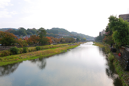
Ishikawa Prefecture is located at the center of the Hokuriku Region, bordering Toyama and Gifu prefectures to the east and Fukui Prefecture to the south. Its long and narrow terrain runs from southwest to northeast, with its tip protruding into the Sea of Japan. The prefectural land is divided into north and south in the Noto and Kaga districts with Hodatsushimizu Town, Kahoku City and Tsubata Town as the boundary. The topography of the two districts differs significantly with the Noto district largely comprising low mountains and hilly terrain with an altitude of 300 meters or less. The Sotoura area with its coast facing the Sea of Japan has well-developed river terraces, while a contrasting quiet coastline with gentle waves extends along the Uchiura area, located on the Toyama Bay side.
Meanwhile, the Kaga district is characterized by its mountainous areas with the highest peak of Mt. Haku at an elevation of 2,702 meters. River erosion and sedimentation have formed a wide plain. Sand dunes stretch along the length of its coastline, which is one of the longest in Japan, except in the south. The plains have a relatively mild climate although the area experiences cloudy and rainy weather that can last for several days due to the winter storm phenomenon that is unique to the Hokuriku region.
Video provided in part by: “SHUN GATE,” a website for the transmission of information on Japanese food culture
Stores interviewed: Aoki Cooking School and Hacchoya
From the separation of Noto and Kaga provinces to the establishment of Kaga Domain
During the Ritsuryo period, Noto and Kaga provinces, which constituted Echizen Province, separated over time with the establishment of Noto Province in the mid-8th century and Kaga Province in the early 9th century
In the early modern era, when the Edo shogunate system was instituted, Noto, Kaga, and Etchu provinces (present-day Toyama Prefecture) became the territory of the Kaga Domain. Following the death of Lord Maeda Toshiie, one of the leading generals during the Sengoku period, the domain is said to have earned the rights to land worth 1.2 million koku of rice, which consequently created the term “Kaga Hyakumangoku” or Kaga with one million koku of rice.
Different food cultures developed in these distinctive districts with a diverse history and lifestyle: the Noto district surrounded by the sea, the Kaga district with a sprawling plain, and the Kanazawa environs that prospered as a castle town. What are the features of these food cultures?
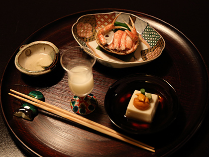
Image provided by: “SHUN GATE,” a website for the transmission of information on Japanese food culture
Noto district
A key maritime transport hub where a seafood-based food culture is embedded
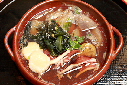
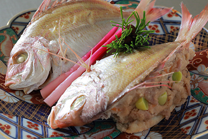
Fishing methods such as trawling, pole fishing and fishing by ama divers developed in Sotoura. The popular fishing method in Uchiura is yellowtail fishing using fixed nets. Inshore fish, shellfish and seafood continue to be part of the daily diet in the coastal areas where a food culture that relies on food from the ocean has taken root. Wheat and azuki beans were grown in inland areas with a lot of snowfall. Barley was eaten on a daily basis, coupled with “satoimo meshi” (rice cooked with taro) and “daikon meshi” (rice cooked with daikon radish) in autumn. Wheat grown in the mountain fields is processed into udon and somen noodles.
The “Journal of Japanese Seafood Products” published in the Taisho era has a description of ishiru from Noto, suggesting that ishiru production had already been established as an industry by that time. In the old days when transportation was inconvenient, Ishiru-nabe, a nabe stew dish seasoned with fish sauce, used to be a delicacy among people in the mountain villages where fish was a rare commodity.
Kaga district
Largest grain-producing region in the prefecture, created by a class-A river
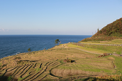
Kaga Plain is a vast, fan-shaped plain, created by the “Tedori River,” the largest, class-A river in Ishikawa Prefecture that spreads in the central and southern parts of the prefecture. With an area of about12,000 hectares, the plain covers eight municipalities including Kanazawa, Komatsu, and Kaga. A water control expert named Eda Gombei built seven irrigation canals from the end of the Edo period to the beginning of the Meiji era to improve the soil that was unfit for planting rice due to its high levels of drainage. Consequently, Kaga Plain eventually developed into a grain-producing region that is the pride of Ishikawa Prefecture. The name Eda Gombei is passed on in legends to this day as “the father of the seven canals of water.” Although rice is now grown throughout the prefecture, most of the areas under cultivation can be found in Hakusan City, Kaga City and Komatsu City in Kaga district.
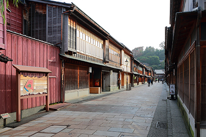
Kanazawa City and its environs
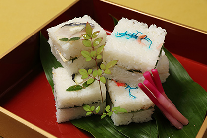
A variety of samurai dishes developed during the feudal era
It was this historical background that contributed to the development of a unique culture in Kanazawa City. This is also evident in its food culture, where seafood and farm products gathered from all over the region supported the development of a samurai cuisine.
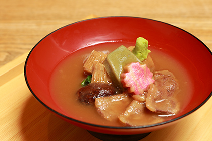
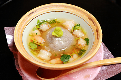
Ishikawa prefecture's main local cuisine


Contact
Food Cultures Office, Overseas Market Development and Food Cultures Division, Food Industry Affairs Bureau, Ministry of Agriculture, Forestry and Fisheries
Tel:+81-3-3502-5516